Visiting the Valles Caldera National Preserve in northern New Mexico reminded me of my Ireland trip, where people who know the area assume their directions will be sufficient. They are not.
I got there at 7:45 a.m. and was second in line. They only have 12 walk-in permits per day (and 12 reservations, which I’m apparently allergic to). I was in good shape to do the 8-mile loop around the main crater at Valles Caldera, an excellent way to end my time in the Jemez Mountains.
I got checked in and asked about this rim trail, and the friendly ranger pointed the trailhead out on the map. It looked sort of clear, so my mistake was not clarifying further, as in: Friendly sir, are you suggesting I’ll park there and see an obvious trail head, where I can obviously get on the trail?
I think you can guess where this is going. (Note the “mishap” tag on this blog post.)
But let me back up. Sam was staying with Sadie because dogs aren’t allowed in the park, plus we had a 2 p.m. checkout time at the campsite, and I was not going to pay for another night just because I was late. So time was important, as in, not wasting any.
Back at the park, I took my (misleadingly helpful) map and headed in the direction I was (stupidly) thinking I should go. My new trekking poles were calling my name from the back of the Pilot, and I was ready for a long, satisfying volcano hike.
This was at 8:30 a.m. By 11:30 a.m. I had a) driven and driven until I ended up on some bone-jarring road that finally dumped me at a dead end; b) bushwacked my way up a forested hill, to what I thought would be the trail head (although not really – even I knew the park wouldn’t subject tourists to such a strenuous and ungroomed trail) and had to come down in defeat; c) tried every seemingly possible side road with no success; and d) used every curse word I knew, which grew increasingly louder the later it got.
Finally, I called the visitor center. There’s a reason why they give you a card with their number, because I’m sure I’m not the first visitor to get lost. I called – six times, because there’s almost no cell service – and after I explained my predicament, telling the ranger I wanted to find the trailhead for the rim trail around the crater (that’s clearly noted on the map they gave me), he kept repeating that the caldera was 12.5 miles wide, so he wasn’t sure which rim trail I was referring to. I kept saying – it looks much smaller than that on the map. He kept reiterating his point.
He did tell me about a trail head for a rim trail, which didn’t sound right at all (I drove over there, and it wasn’t), and at the end of our conversation he admitted that their signage wasn’t what it should be. (Like, existent.)
At that point there was no way I could do an 8-mile hike and get back in time to rescue Sam and get out of camp by check-out, so I called it, and headed out of the park. On my way, I saw what may have been what the ranger was talking about – a small dirt road blocked by wood that headed up a hill. I’m guessing that if I had walked up that road awhile, I would have finally found the mythical trailhead to the crater. But I was so crabby at that point, I just gave it the finger as I drove by.
As I left, the woman at the gate looked at her watch, clearly surprised I was leaving so early in the day, and asked, “What did you do in there?” I smiled and said, “I made some photographs. I’ll have to come back.” No need to be crabby with anyone but myself.
I did get some nice shots, and despite my lame experience it’s a really beautiful place – highly recommended. Just do this: ask questions and force the rangers to be specific. Maybe landmarks would have helped? I don’t know. (And bonus for Longmire fans – they film the show there, though having not seen the show at that point, I didn’t take a photo of Walt’s cabin.)
Valles Caldera is 89,000 acres, a working ranch, and (apparently) has lots and lots of obsidian from the volcano and even Native American artifacts like arrowheads. (Which you can’t take home, natch, but still, it’s great that they’re still there.) Go.
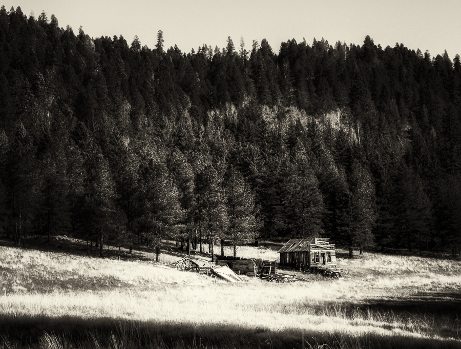
An abandoned shack on the property.
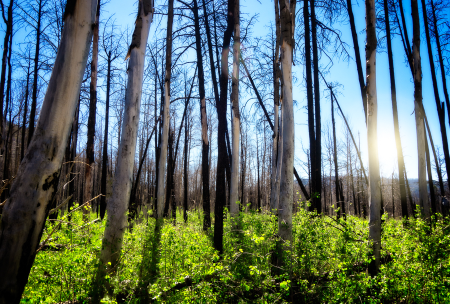
Does this look like a trail to you? Yeah, me neither. It was beautiful, though.
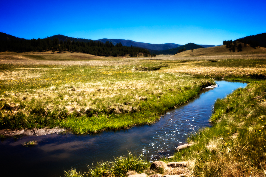
A creek runs through the caldera.
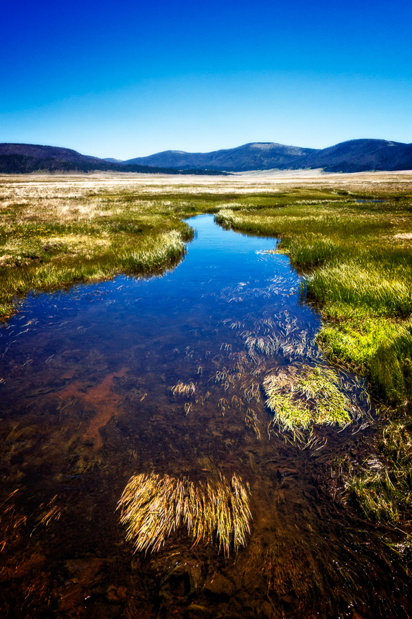
Okay, one more shot of the creek.
If you liked this post, feel free to share it with the buttons below!
Lousy experience, but what a beautiful place! Glad you got out in one piece.
Emilie Vardaman recently posted…Apple Annie’s
Emilie – Yes, after I got over my crabbiness I was happy with the day. 🙂
I just have to say this: What did you expect? It IS run by the government, after all. O.o Irritating as heck, though. Grr.
Deborah – National Parks are usually much easier to navigate, but this one is newly designated and they were still operating on more of a private model. I’m hoping that in time they’ll get it together so visitors can have a better, deeper experience of the place.
wonderful!
Ron Hagg recently posted…HAGGMEDIA
Thanks, Ron!
I am SO glad I’m not the only one that has experiences like that! LOL I love your story as much as the photos! Really…. 🙂 Again, keep in touch and hope we can meet up somewhere along the line in the next few months (if you don’t get lost on a volcano somewhere that is).
Sherry in MT recently posted…New Nuthatch
Sherry – I keep telling you, we’re kindred spirits. 🙂 I’m heading out next week for the west coast (I have another show in L.A.), but let’s be in touch, would love to see you out there.